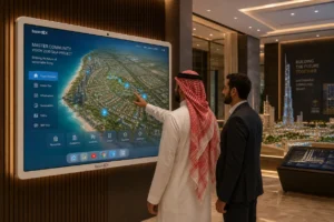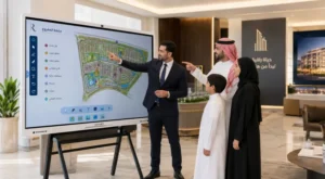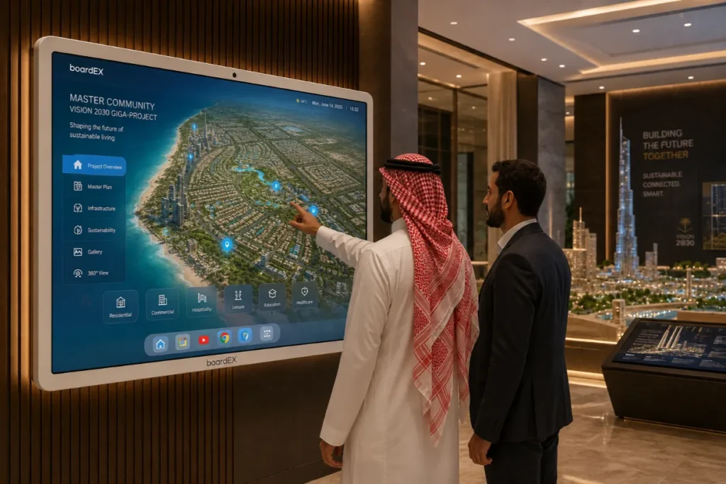
A touch-screen master plan display is a large interactive screen that shows a whole development as a live map buyers can explore with their hands. Instead of flipping through printed boards, a visitor taps a district to open it, taps a plot to see what is planned there, and follows the road from a school to the nearest park.
For giga-projects and master communities that are too large to explain on paper, the screen turns a long explanation into a short conversation.
Table of Contents
Why big developments are hard to explain on paper
Saudi Arabia is building at a scale that printed material was never designed for. A master community can hold tens of thousands of homes, several schools, retail streets, mosques, parks and a transport link, all delivered in phases across many years.
Try to show that on a board, and you hit three problems at once.
The first is size. Print the whole plan, and the detail disappears. Print the detail, and you lose the sense of how it all connects.
The second is time. A master plan is not one picture; it is a sequence. Phase one looks nothing like phase four. A flat drawing can only show one moment, and it is usually the finished moment that is still ten years away.
The third is the question. Every visitor arrives with a different one. A family wants to know the walk to the nearest school. An investor wants to know which phase completes first. A printed board answers neither, so a salesperson ends up talking over the top of it.
What is a touch-screen master plan display?
It is a large interactive panel running a map of the development that responds to touch. The visitor is not watching a video. They are moving through the plan themselves.
A typical setup lets someone:
- Zoom from the full site view down to a single street or plot
- Tap any zone to see what is planned there, with photos and short descriptions
- Switch between phases to see how the site changes over time
- Turn layers on and off, such as schools, green space, retail or road access
- Open a unit to see its floor plan, orientation and view
- Follow a route between two points to answer distance questions directly
The screen sits at the centre of the sales space, usually on a wall or a floor stand, at a height where an adult can reach the top of the map comfortably. Everything else in the room supports it rather than competing with it.
Master plan presentation is one job among several that the same screen handles once it is in place, alongside unit availability and client meetings, and the wider role of an interactive flat panel in real estate sales centres is worth understanding before deciding how the room is laid out.
How a touch-screen presentation actually runs
The change is not really about the technology. It is about who is doing the talking.
With printed boards, the salesperson presents, and the visitor listens. The order is fixed, the pace is fixed, and the visitor waits for the part they came for.
With an interactive master plan, the visitor leads. They point at what interests them, and the screen goes there. The salesperson stops presenting and starts answering, which is a far better use of their time and a much easier conversation for the buyer.
A session usually falls into four simple steps.
| Step | What happens on screen | What it does for the buyer |
| 1. The whole picture | Full site view with main zones and road links | Gives them a sense of scale and location before any detail |
| 2. Their area | Zoom into the district that matches their budget or family needs | Narrows a huge project down to something they can picture living in |
| 3. Their question | Layers switched on for schools, parks, retail or parking | Answers the thing they actually walked in to ask |
| 4. Their unit | Plot opened, floor plan and orientation shown | Moves the conversation from the project to a specific home |
A small detail that changes everything: let the visitor touch the screen themselves. Sales teams often keep hold of the control out of habit, and the moment they do, the display becomes an expensive television. The value only appears when the buyer’s own hand is on the glass.
Showing phases without confusing people
Phasing is the hardest part of any giga-project conversation, and it is where an interactive display earns its place.
Buyers worry about the same things. Will my street be a building site when I move in? When does the school open? Is the park in phase one or phase five?
A phase slider answers all of it in a few seconds. Drag it, and the site fills in gradually. What is built stays solid; what is coming appears in outline. Nobody needs a delivery schedule explained to them, because they just watched it happen.
Two rules keep it honest. Show what is confirmed as confirmed and what is planned as planned, using clearly different styling. And avoid dates you cannot commit to. A phase order is a promise you can keep. A month and a year is a complaint waiting to happen.
Making the map answer real questions
The layer function is where most master plan displays are underused. Teams build a beautiful map and then leave it as one flat image.
Layers are worth building because they match how people actually decide. Nobody buys a plot. They buy the school run, the commute, the place they walk in the evening.
- Education layer: nurseries and schools, with walking distance from any plot
- Daily needs layer: supermarkets, pharmacies, clinics
- Green and leisure layer: parks, walking routes, sports facilities
- Faith layer: mosques and prayer facilities by district
- Access layer: main roads, exits, public transport links, travel time to the city centre
- Delivery layer: what is complete, under construction and planned
Each layer should work on its own and in combination. A buyer who turns on schools and green space at the same time is telling you exactly what matters to them, and a good sales team notices that.
Arabic and English on the same screen
A sales centre in the Kingdom serves Saudi families, regional buyers and international investors, often within the same hour. The display has to switch language without switching experience.
Three things need checking before launch.
Text must flow right to left properly in Arabic, not just get translated and left aligned to the left. Place names must use the form people actually say, not a literal translation that no local recognises. And the switch itself should be one visible tap, not something buried in a settings menu that a salesperson has to hunt for while a customer waits.
Bilingual capability is standard on modern panels rather than a special build, and the language handling on the boardEX interactive flat panel covers both interfaces natively. The work that remains is in the master plan content itself, which is the developer’s own material.
Where the screen goes in the room
Placement decides whether the display gets used or ignored.
| Decision | What works | Why |
| Position in the room | Visible from the entrance, reachable within a few steps | People approach what they can see, and ignore what sits behind a desk |
| Mounting height | Map centre at roughly eye level, top edge within arm’s reach | Nobody stretches to use a screen; they just stop using it |
| Space in front | Room for three or four people to stand side by side | Families arrive together and decide together |
| Seating nearby | A table within a few steps | The conversation moves from standing at the map to sitting down to talk numbers |
| Lighting | No window or spotlight reflecting off the glass | Glare kills a touch screen faster than any technical fault |
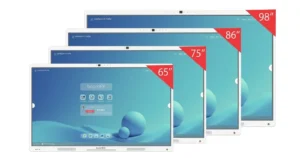
| Screen size | Large enough that two people can point at different areas at once | A small screen forces people to take turns, which breaks the conversation |
Getting the content ready
Most delays are not technical. The panel arrives quickly. The map takes longer.
Start gathering these early:
- The current master plan file, in a format that stays sharp when zoomed
- An agreed phase list, in order, with what belongs in each
- Unit and plot data that matches the sales system, so the screen never shows something already sold
- Renders and photos for the zones buyers ask about most
- Both language versions of every label, checked by someone who speaks each one
- A named person who owns updates once it is live
That last point is the one that gets skipped and causes the most trouble. A master plan changes. If nobody owns the screen, it slowly drifts out of date, and a wrong plan shown confidently is worse than no screen at all.
Beyond the sales centre
The same content earns its keep in other places once it is built.
Property exhibitions and roadshows use a portable version on a stand, where a touch map draws far more attention on a busy floor than a printed banner. Investor and board meetings use it to walk stakeholders through delivery progress. Handover and community offices keep a simplified version so residents can find facilities as the community fills up.
The presentation tools that make this work in a meeting room, such as annotating directly over the plan and saving those marked-up views, are part of the standard interactive flat panel features set rather than anything custom.
Common mistakes to avoid
- Loading a PDF and calling it interactive. If it cannot be tapped, it is a poster on a screen.
- Too much detail at the first view. Open with a simple picture. Detail comes when it is asked for.
- Tiny tap targets. Anything a finger needs to hit must be large enough to hit first time.
- No offline fallback. If the map needs the internet and the connection drops during a viewing, the sale stalls.
- Training nobody. A sales team that has not practised will avoid the screen in front of a real customer.
- Letting it go stale. Sold units still showing as available damages trust immediately.
Planning a sales centre display?
boardEX supplies and installs large-format interactive displays across Riyadh, Jeddah, Dammam and Khamis Mushayt, with a site visit before anything is specified.
Frequently asked questions
What is a touch screen master plan display?
It is a large interactive screen showing a development as a map that visitors explore by touch. They zoom from the whole site down to a single plot, tap zones to see what is planned there, switch between construction phases, and view floor plans for individual units. It replaces printed presentation boards in a sales centre and lets the buyer follow their own questions instead of sitting through a fixed presentation.
What screen size works best for a master plan?
Larger sizes suit master plans better than they suit meeting rooms, because two or three people usually stand at the screen together and need to point at different parts of the map at the same time. The practical test is whether a full site view still shows readable street names without zooming. If it does not, the screen is too small for the development, and the display should be specified based on a site visit rather than picked from a size chart.
Can a master plan display show construction phases?
Yes, and it is one of the strongest reasons to use one. A phase control lets the visitor watch the site fill in step by step, with completed work shown differently from planned work. This answers the questions buyers of off-plan property care about most, such as when the school opens and whether their street will still be under construction at handover, without anyone reading out a delivery schedule.
Does the display need an internet connection to work?
It should not. Master plan content is best stored on the panel itself so a viewing never depends on the sales centre connection staying up. A network link is still useful for pulling live availability from the sales system and for pushing updates, but the core map, phases and floor plans should keep working normally if the connection drops mid-presentation.
How is a master plan display different from digital signage?
Digital signage broadcasts. It plays scheduled content to whoever happens to be looking, and nobody touches it. A master plan display is the opposite: it does nothing until a visitor takes control, and every session follows a different path depending on what that person wants to know. A sales centre often uses both, with signage in the waiting area and an interactive display where the actual conversation happens.